Within the framework of the LIFE OrgBalt project “Demonstration of climate change mitigation potential of nutrient rich organic soils in Baltic States and Finland”, depth-to-water maps for the entire territory of the Baltic States have been created. Thanks to aero laser scanning, new data on ground surface relief made it possible to model water accumulation sites, surface water runoff directions, including the smallest streams, as well as the overall water table depth in larger areas, thus offering an excellent support to soil management planning and practices.
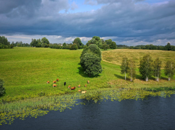
Water and soil moisture play an important role in forestry, agronomy and other land use. “Poorly drained and wet soils can represent a challenge for these sectors from an environmental point of view (e.g., because of low soil bearing capacity and high water stress), but also impact the economic activity and generate financial losses”, highlights Jānis Ivanovs, Scientific assistant at Latvian State Forest Research Institute “Silava” and creator of the maps, elaborated according to the methodology developed by Murphy et al., 2008. A clever use of depth-to-water maps can therefore contribute to smart water and land management practices in order to mitigate the presented risks and resolve some lingering problems. For example, these maps can be used for actions including but not limited to: planning of movement of forestry machinery with the aim to minimise soil damage; assessment of drainage systems on agricultural land; organisation of water runoffs to control water regime; selection of suitable planting species according to the soil moisture properties and many more.
In combination with wet area maps which will be developed later on in the project, the new depth-to-water maps are an essential tool in the LIFE OrgBalt project’s climate change mitigation activities. They will help to assess the distribution of historical organic soils and to predict the spatial distribution of soil moisture. Water management has a direct impact on nutrient rich organic soils as soil moisture is one of the key drivers of greenhouse gas (GHG) emissions. Water levels determine whether the soil works as a climate change mitigator or enhancer, i.e., either by being a GHG sink or on the contrary – the source of GHGs releasing them to the atmosphere. The measurements can serve as a reference for new action implementation and can be used as a comparison for a better analysis of the achieved results. The possibility to predict spatial distribution of soil moisture gives the opportunity to identify problematic, high-risk areas and to elaborate strategies for improved water management in order to reduce GHG emissions. For instance, depth-to-water maps can be used to organise water runoffs by creating deep furrows to optimise the water regime in places where it is currently too high.
Depth-to-water maps can serve as a functional tool for the main players involved in forestry, agriculture and land use sectors. The versatile application of the data gives the opportunity to research for customized solutions, adapted to each particular area, thus helping with the planning and implementation of more efficient and climate-smart land management activities in the Baltic states.
For more information: Technical article about depth-to-water maps
The project “Demonstration of climate change mitigation potential of nutrient rich organic soils in Baltic States and Finland” (LIFE OrgBalt, LIFE18 CCM/LV/001158) is implemented with the financial support of the LIFE Programme of the European Union and the State Regional Development Agency of Latvia.
The developed material reflect only the LIFE OrgBalt project beneficiaries’ view and the European Climate, Infrastructure and Environment Executive Agency is not responsible for any use that may be made of the information contained therein.
